あわせて読みたい
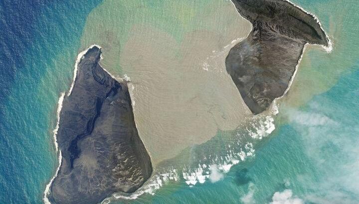
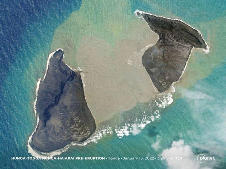
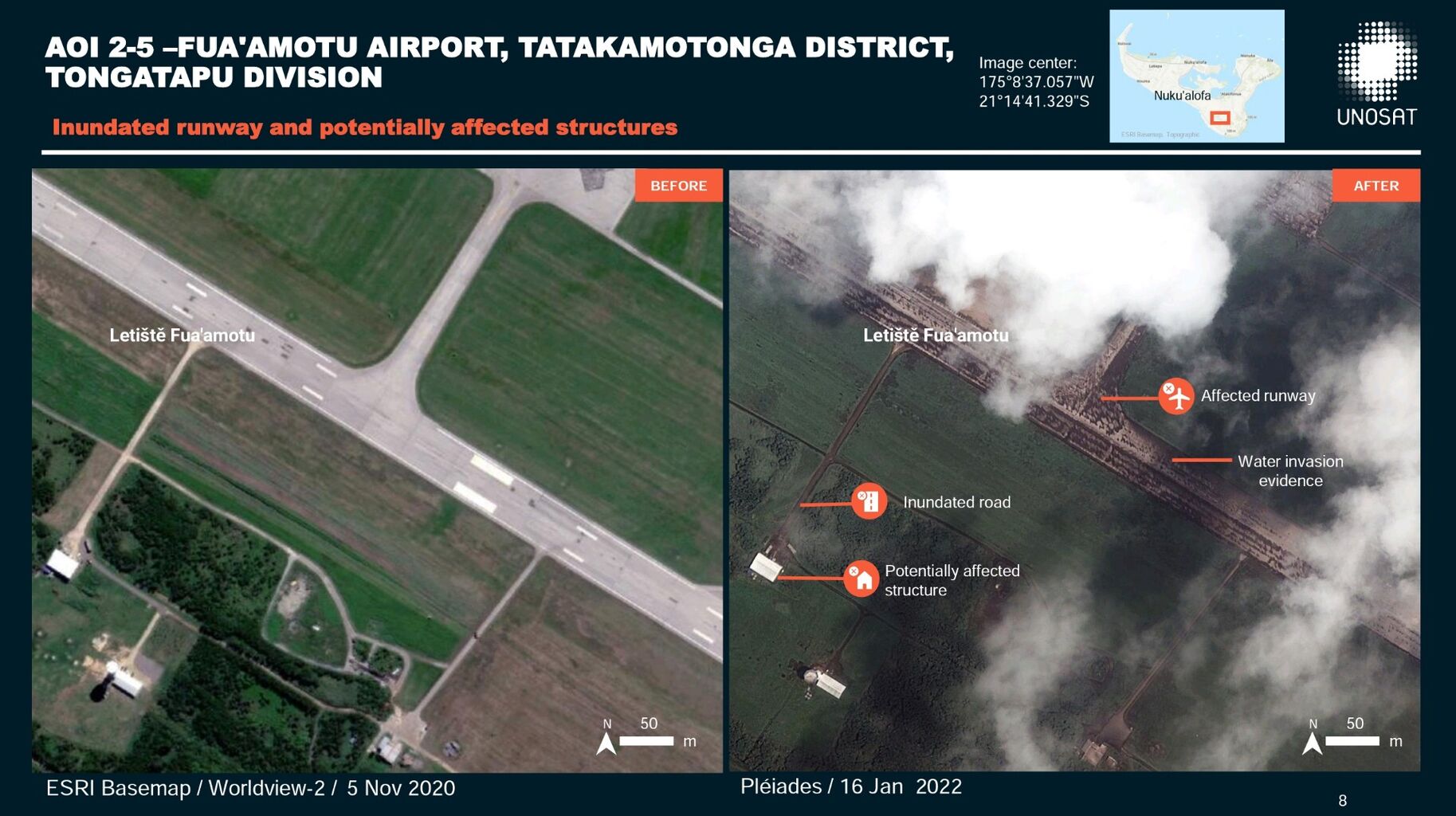
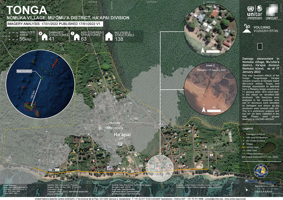
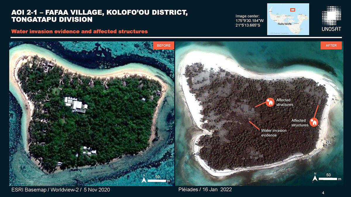
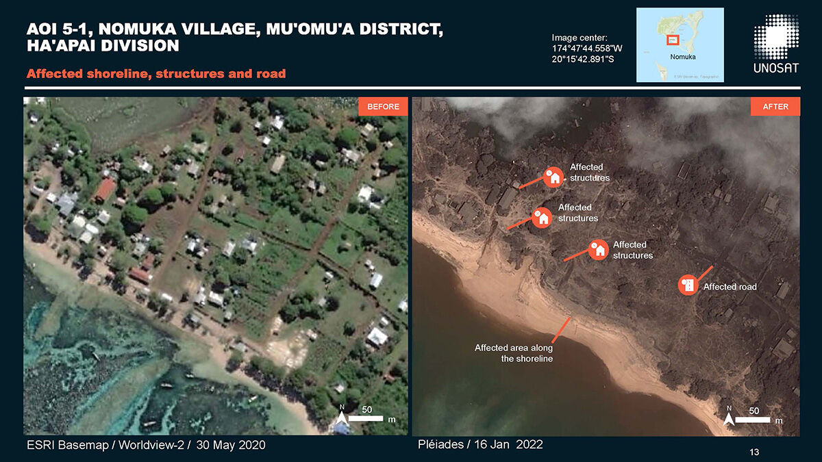
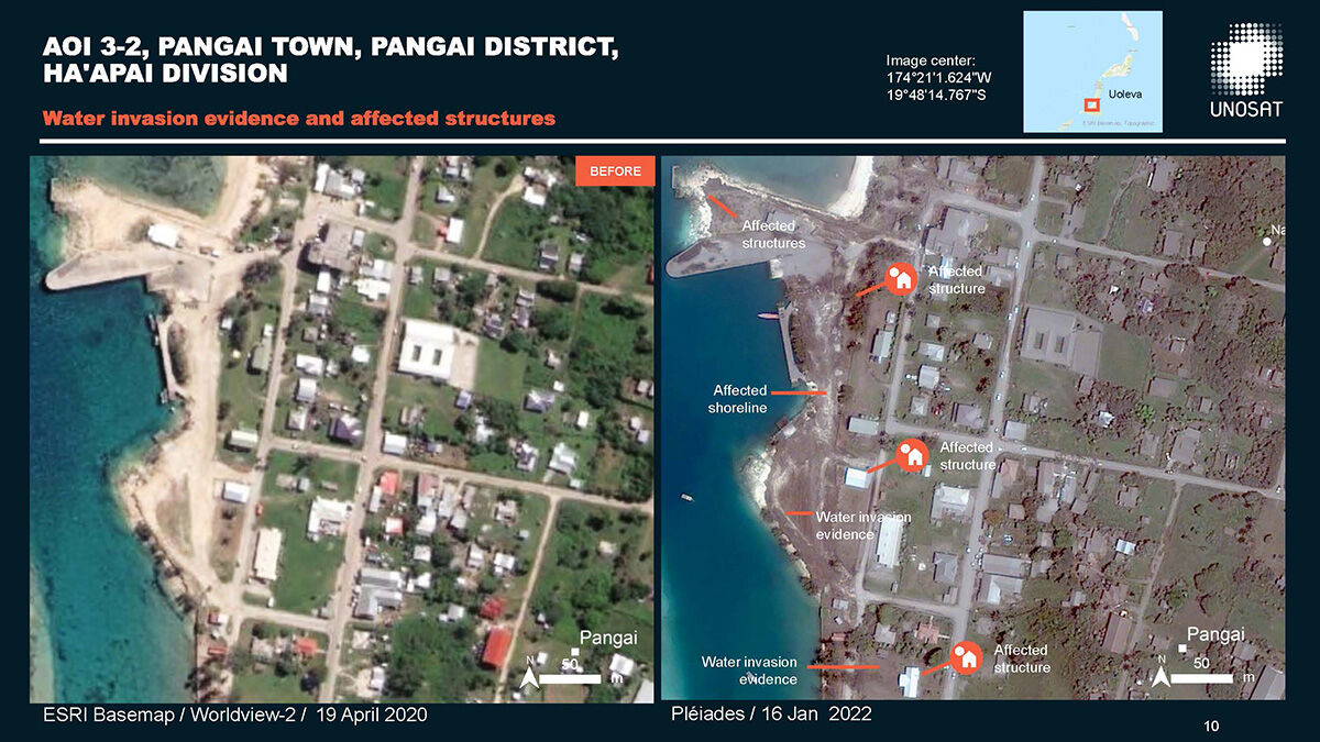
【トンガ大噴火】衛星写真で見る大規模火山噴火の前と後(※津波の被害を受けた地域の画像が含まれています)
(上)トンガ本島(トンガタプ島)・ファアモツ国際空港
(下)ハアパイ諸島・ノムカ島のノムカ村(現地時間17日午前撮影)@DisastersChartツイートより
Disasters Charter
@DisastersChart
.@UNOSAT produced a preliminary assessment of the impact from #HungaTongaHungaHaapai volcano: https://t.co/hZ4vheqRwg
See a few extracts from the report, providing before and after comparisons using #Pleiades, #Sentinel2 and WorldView imagery. #TongaVolcano
(.@UNOSAT が#HungaTongaHungaHaapai volcano からの影響に関する予備評価を作成:
#Pleiades、#Sentinel2、WorldViewの画像を使用した前後比較のレポートから抜粋したいくつかをご覧ください。#TongaVolcano)
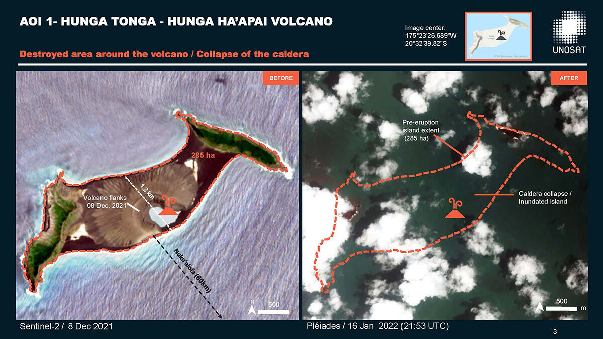
(出典 pbs.twimg.com)
https://twitter.com/DisastersChart/status/1483081934238584838
@StefLhermitte
.@planet 🛰 imagery shows how the tsunami 🌊 following the 🌋 wiped away all settlements on northern part of Tonga’s main island 🇹🇴.
(トンガ本島北部の集落が 🌋 に伴う津波でwipedした様子が@planet 🛰 の画像で確認できます。)
(出典 imgur.com)
https://twitter.com/StefLhermitte/status/1483008886286266370
関連記事
トンガ海底火山、噴火で陸地がほぼ消滅 衛星写真で判明
https://mainichi.jp/articles/20220118/k00/00m/030/003000c
関連リンク
Volcanic eruption in Tonga and the Pacific
https://disasterscharter.org/web/guest/activations/-/article/ocean-wave-in-tonga-activation-744-
直リンク(pdf)
https://disasterscharter.org/documents/10180/10918331/vap-855-1-product
https://twitter.com/5chan_nel (5ch newer account)
